
Data Stories: Using Maps to View History
As a visualization, a map can show more than what turn to take next. In these examples, you can see a city’s past, where slavery spread, and indigenous territories.
- By Upside Staff
- May 2, 2018
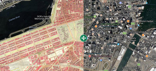
You might think making a map would be straightforward, but someone creating a map makes specific choices of what to show. Mapjunction allows you to compare maps created at different times through an interactive overlay. The project currently covers Boston and the surrounding area.
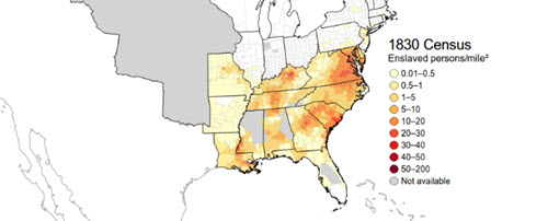
This article from Smithsonian magazine took historical census and map data and used it to create new animated maps that show multiple dimensions of the history of slavery in the U.S.
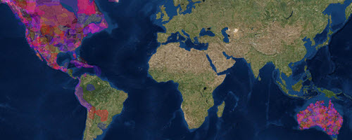
Native Land is a mapping project attempting to collect information about traditional territories and provide it on interactive maps to spark interest in indigenous history. You can view sources by clicking a region and then clicking the link(s) on the left.