
Data Stories: Distance to Airports, How Fast Can You Travel, Fictional Speeds
Are you traveling this summer? Data visualizations compare airport proximity, historical travel times, and fictional vehicle speeds.
- By Lindsay Stares
- June 28, 2017
Travel Time to the Airport
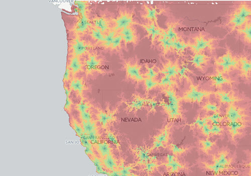
This map from City-Data shows travel time by car to major airports in the U.S. Is air travel convenient where you live?
The Speed of Today’s Global Travel
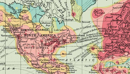
In 1914, a map was published that showed how far you could travel from London in 5, 10, 20, 30 or more than 40 days. An updated version for 2016 shows that now you can arrive nearly everywhere on Earth in less than two days.
Faster than a Fictional Spaceship
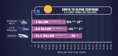
Do you need to go faster than a transcontinental jet? This amusing infographic compares the speeds of fictional characters and vehicles. At the bottom of the blog post, the methodology is particularly interesting; it explains how the various data points were found or calculated.
About the Author
Lindsay Stares is a production editor at TDWI. You can contact her here.