Data Stories: Camping, Tourism, and Mapmaking
Warmer weather and summer vacations will be here soon; celebrate by planning a camping trip, learning about tourism problems, and looking at elaborate hand-drawn maps.
- By Upside Staff
- May 1, 2019

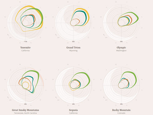
These charts show the most popular times of year to spend the night in various National Parks across the U.S.

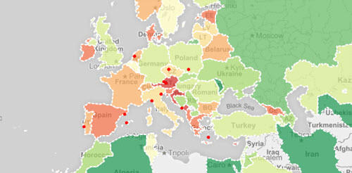
This map highlights countries struggling with exceptionally high tourism rates compared to the population. Click the question mark in the sidebar to learn about the project.
City Maps as Art

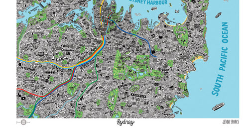
Illustrator Jenni Sparks creates elaborate hand-drawn maps that don’t feature roads and addresses -- instead she brings all the little characteristics of a city to life. In this post, read about the process she used to map Sydney, Australia. If you love her work, large prints of several different city maps are for sale.